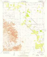
1956 Map of Valerie
USGS Topo · Published 1957About this map
The Torres Martinez Indian Reservation occupies much of this landscape, where the arid valley floor meets the steep eastern slopes of the Santa Rosa Mountains. This mid-century survey records a desert environment being shaped by water management and cultural heritage, most notably at the Early Indian Fish Traps and nearby Petroglyphs situated along the mountain base. These archaeological markers sit just above the former shoreline of ancient Lake Cahuilla, contrasting with the modern irrigation efforts indicated by the Coachella Valley Stormwater Channel and numerous grid-aligned agricultural plots.
Find a feature on this map
34 named features on this map. Tap any name to fly to it.
Don’t see what you’re looking for? This feature index may not catch every label — zoom into the map to look around manually.
Map Details
Editions of this 1956 Valerie Map
4 editions found
Other maps of this area

1904 · Indio
USGS Topo · 1:125,000

1931 · Vallecito
USGS Topo · 1:125,000

1941 · Toro Peak
USGS Topo · 1:62,500

1941 · Clark Lake
USGS Topo · 1:62,500

1941 · Coachella
USGS Topo · 1:62,500

1942 · Agua Dulce
USGS Topo · 1:62,500

1942 · Clark Lake
USGS Topo · 1:62,500

1943 · Vallecito
USGS Topo · 1:125,000

1943 · Coachella
USGS Topo · 1:62,500

1944 · Agua Dulce
USGS Topo · 1:62,500