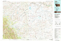
1984 Map of Valier
USGS Topo · Published 1984About this map
The Blackfeet Indian Reservation dominates the northern expanse of this 1984 survey, where the prairie meets the high peaks of the Sawtooth Range. This landscape is defined by the transition from the high-mountain drainage of the Bob Marshall Wilderness to the organized agricultural colonies of the plains. A distinctive social geography is visible through the numerous Hutterite settlements, including Kingsbury Colony, Birch Creek Colony, and New Miami Colony, which punctuate the territory between the Marias River and Lake Frances.
Find a feature on this map
71 named features on this map. Tap any name to fly to it.
Don’t see what you’re looking for? This feature index may not catch every label — zoom into the map to look around manually.
Map Details
Editions of this 1984 Valier Map
This is the sole edition of this map. No revisions or reprints were ever made.
Other maps of this area

1886 · Great Falls
USGS Topo · 1:250,000

1901 · Browning
USGS Topo · 1:125,000

1903 · Browning
USGS Topo · 1:125,000

1903 · Saypo
USGS Topo · 1:125,000

1907 · Blackfoot Res.
USGS Topo · 1:48,000

1909 · Cut Bank
USGS Topo · 1:125,000

1911 · Blackfoot
USGS Topo · 1:125,000

1912 · Cut Bank
USGS Topo · 1:125,000

1913 · Marias Pass
USGS Topo · 1:125,000

1914 · Heart Butte
USGS Topo · 1:125,000