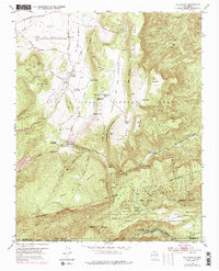
1953 Map of Vallecitos
USGS Topo · Published 1978About this map
The Town of Abiquiu Grant and Juan Jose Lobato Grant overlap in this northern New Mexico landscape, creating a complex history of land tenure and grazing. The settlement of Vallecitos sits near the confluence of La Joya Tio Gregorio Creek and several mountain drainages, serving as a focal point for the surrounding ranches and small communities like Los Cerritos. The terrain is defined by massive landforms such as Mesa Lobato and Mesa Gallina, which rise sharply above the Rio Oso and Gallina Creek watersheds.
Find a feature on this map
57 named features on this map. Tap any name to fly to it.
Don’t see what you’re looking for? This feature index may not catch every label — zoom into the map to look around manually.
Map Details
Editions of this 1953 Vallecitos Map
3 editions found
Other maps of this area

1892 · Santa Clara
USGS Topo · 1:125,000

1918 · Abiquiu
USGS Topo · 1:125,000

1952 · Valle Toledo
USGS Topo · 1:24,000

1952 · Puye
USGS Topo · 1:24,000

1952 · Guaje Mountain
USGS Topo · 1:24,000

1953 · Canones
USGS Topo · 1:24,000

1953 · Chili
USGS Topo · 1:24,000

1953 · Abiquiu
USGS Topo · 1:24,000

1953 · Medanales
USGS Topo · 1:24,000

1953 · Vallecitos
USGS Topo · 1:24,000