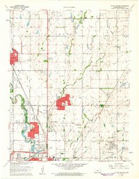
1960 Map of Valley Center
USGS Topo · Published 1961About this map
Valley Center stands as a primary hub of settlement in northern Sedgwick County, defined by its intersection with the Atchison Topeka and Santa Fe railroad. The landscape is a mix of agricultural tradition and industrial development, characterized by the Goodrich Oil Field and Kuske Oil Field to the north. Water management is a dominant theme, visible in the winding path of the Little Arkansas River and the significant engineering of the Wichita-Valley Center Floodway.
Find a feature on this map
49 named features on this map. Tap any name to fly to it.
Don’t see what you’re looking for? This feature index may not catch every label — zoom into the map to look around manually.
Map Details
Editions of this 1960 Valley Center Map
4 editions found
Other maps of this area

1889 · Wichita
USGS Topo · 1:125,000

1894 · Wichita
USGS Topo · 1:125,000

1941 · Maize
USGS Topo · 1:31,680

1941 · Valley Center
USGS Topo · 1:31,680

1942 · Valley Center
USGS Topo · 1:31,680

1942 · Maize
USGS Topo · 1:31,680

1943 · Wichita West
USGS Topo · 1:31,680

1943 · Wichita East
USGS Topo · 1:31,680

1945 · Andover
USGS Topo · 1:31,680

1955 · Greenwich
USGS Topo · 1:24,000