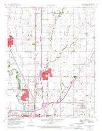
1960 Map of Valley Center
USGS Topo · Published 1971About this map
The Wichita - Valley Center Floodway and the Little Arkansas River define the western landscape of this mid-century Sedgwick County survey. The map documents the northern expansion of Wichita through growing suburban developments like Park City, Wichita Heights, and Riverview. These communities are serviced by numerous educational and spiritual centers, including Chisholm Trail Sch, Keechi Center Sch, and Hillcrest Ch.
Find a feature on this map
55 named features on this map. Tap any name to fly to it.
Don’t see what you’re looking for? This feature index may not catch every label — zoom into the map to look around manually.
Map Details
Editions of this 1960 Valley Center Map
4 editions found
Other maps of this area

1889 · Wichita
USGS Topo · 1:125,000

1894 · Wichita
USGS Topo · 1:125,000

1941 · Maize
USGS Topo · 1:31,680

1941 · Valley Center
USGS Topo · 1:31,680

1942 · Valley Center
USGS Topo · 1:31,680

1942 · Maize
USGS Topo · 1:31,680

1943 · Wichita West
USGS Topo · 1:31,680

1943 · Wichita East
USGS Topo · 1:31,680

1945 · Andover
USGS Topo · 1:31,680

1955 · Greenwich
USGS Topo · 1:24,000