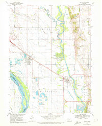
1968 Map of Valley
USGS Topo · Published 1972About this map
The Elkhorn River meanders across this eastern Nebraska landscape, defining the character of the river valley between Valley and Waterloo. In the late 1960s, this region was shaped by its water and transport links, with the Union Pacific and Chicago and North Western railroads crossing the plains. The map reveals an interesting pattern of gravel extraction and water reclamation, evidenced by numerous sandpits and modern developments like Riverside Lakes and Lake Taormina.
Find a feature on this map
39 named features on this map. Tap any name to fly to it.
Don’t see what you’re looking for? This feature index may not catch every label — zoom into the map to look around manually.
Map Details
Editions of this 1968 Valley Map
3 editions found
Other maps of this area

1893 · Fremont
USGS Topo · 1:125,000

1896 · Fremont
USGS Topo · 1:125,000

1955 · Fremont
USGS Topo · 1:250,000

1956 · Gretna
USGS Topo · 1:24,000

1957 · Fremont
USGS Topo · 1:250,000

1958 · Fremont
USGS Topo · 1:250,000

1968 · Valley
USGS Topo · 1:24,000

1968 · Leshara
USGS Topo · 1:24,000

1968 · Fremont East
USGS Topo · 1:24,000

1968 · Kennard
USGS Topo · 1:24,000