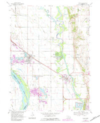
1968 Map of Valley
USGS Topo · Published 1983About this map
The Elkhorn River and Platte River dominate this portion of eastern Nebraska, defining the landscape between the settlements of Valley and Waterloo. The area serves as a critical transportation corridor, with the Union Pacific railroad and major highways cutting through the flatlands. Industrial and recreational land use is evident in the numerous Sandpits and Sandpit operations, many of which have been repurposed into residential lake communities such as Timber Lodge Lake, Lake Taormina, and Riverside Lakes. Local genealogy is well-supported by landmarks like the Elk City Cem and Prospect Hill Cem, alongside historical rural institutions including St John Seminary and School No 41. To the north, the winding course of Rawhide Creek and Big Slough illustrate the natural drainage patterns of the valley floor before reaching the more established town centers.
Find a feature on this map
33 named features on this map. Tap any name to fly to it.
Don’t see what you’re looking for? This feature index may not catch every label — zoom into the map to look around manually.
Map Details
Editions of this 1968 Valley Map
3 editions found
Other maps of this area

1893 · Fremont
USGS Topo · 1:125,000

1896 · Fremont
USGS Topo · 1:125,000

1955 · Fremont
USGS Topo · 1:250,000

1956 · Gretna
USGS Topo · 1:24,000

1957 · Fremont
USGS Topo · 1:250,000

1958 · Fremont
USGS Topo · 1:250,000

1968 · Valley
USGS Topo · 1:24,000

1968 · Leshara
USGS Topo · 1:24,000

1968 · Fremont East
USGS Topo · 1:24,000

1968 · Kennard
USGS Topo · 1:24,000