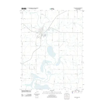
2012 Map of Valley Falls
USGS Topo · Published 2012About this map
The Delaware River winds through this Jefferson County landscape, feeding into the northern reaches of Perry Lake. At the heart of the region sits Valley Falls, organized around a grid of streets including Broadway St and Maple St. The town's local infrastructure is clearly marked, from the Valley Falls Water Tower to the Valley Falls Fairgrounds on the eastern edge of the settlement.
Find a feature on this map
55 named features on this map. Tap any name to fly to it.
Don’t see what you’re looking for? This feature index may not catch every label — zoom into the map to look around manually.
Map Details
Editions of this 2012 Valley Falls Map
This is the sole edition of this map. No revisions or reprints were ever made.
Other maps of this area

1886 · Oskaloosa
USGS Topo · 1:125,000

1888 · Oskaloosa
USGS Topo · 1:125,000

1889 · Topeka
USGS Topo · 1:125,000

1894 · Oskaloosa
USGS Topo · 1:125,000

1894 · Topeka
USGS Topo · 1:125,000

1950 · Kansas City
USGS Topo · 1:250,000
1951 · Oskaloosa
USGS Topo · 1:24,000

1951 · Ozawkie
USGS Topo · 1:24,000
1952 · Meriden
USGS Topo · 1:24,000

1954 · Kansas City
USGS Topo · 1:250,000