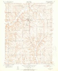
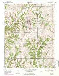
1951 Map of Oskaloosa
USGS Topo · Published 1952About this map
Oskaloosa serves as the central hub of this Jefferson County landscape, situated just south of the North Boundary Old Delaware Reservation. The map reveals a transition in rural education during the early 1950s, marking numerous schoolhouses as recently closed or out of use, including Buck Point Sch, Leaverton Sch, and Parsons Sch. This shift coincides with a shift toward centralized education, though several active sites like Dick Sch and School No 10 remain.
Find a feature on this map
31 named features on this map. Tap any name to fly to it.
Don’t see what you’re looking for? This feature index may not catch every label — zoom into the map to look around manually.
Map Details
Editions of this 1951 Oskaloosa Map
5 editions found
Other maps of this area

1886 · Oskaloosa
USGS Topo · 1:125,000

1888 · Oskaloosa
USGS Topo · 1:125,000

1894 · Oskaloosa
USGS Topo · 1:125,000

1949 · Williamstown
USGS Topo · 1:24,000

1949 · Perry
USGS Topo · 1:24,000

1950 · Perry
USGS Topo · 1:24,000

1950 · Kansas City
USGS Topo · 1:250,000

1950 · Williamstown
USGS Topo · 1:24,000
1950 · Midland
USGS Topo · 1:24,000

1950 · Mc Louth
USGS Topo · 1:24,000