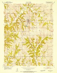
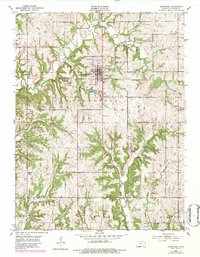
1951 Map of Oskaloosa
USGS Topo · Published 1952About this map
Oskaloosa serves as the focal point of this mid-century Kansas landscape, situated just north of the historical Old Delaware Reservation boundary. The 1951 field check reveals a community in transition, evidenced by several rural schoolhouses marked as abandoned, including Buck Point Sch, Leaverton Sch, and Hinton Sch. This shift suggests a consolidation of rural districts or a change in local population density following the post-war years.
Find a feature on this map
32 named features on this map. Tap any name to fly to it.
Don’t see what you’re looking for? This feature index may not catch every label — zoom into the map to look around manually.
Map Details
Editions of this 1951 Oskaloosa Map
5 editions found
Other maps of this area

1886 · Oskaloosa
USGS Topo · 1:125,000

1888 · Oskaloosa
USGS Topo · 1:125,000

1894 · Oskaloosa
USGS Topo · 1:125,000

1949 · Williamstown
USGS Topo · 1:24,000

1949 · Perry
USGS Topo · 1:24,000

1950 · Perry
USGS Topo · 1:24,000

1950 · Kansas City
USGS Topo · 1:250,000

1950 · Williamstown
USGS Topo · 1:24,000
1950 · Midland
USGS Topo · 1:24,000

1950 · Mc Louth
USGS Topo · 1:24,000