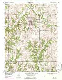
1951 Map of Oskaloosa
USGS Topo · Published 1983About this map
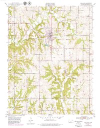
Oskaloosa serves as the central hub of this Jefferson County landscape, positioned just south of the North Boundary Old Delaware Reservation. The terrain is defined by a dense network of drainage, where Honey Creek and Slough Creek flow toward the north while Buck Creek and its tributary, Little Buck Creek, wind through the southern sections. This 1951 survey, updated with 1978 aerial revisions, captures a rural community structured around local landmarks like Bethel Ch and Midway Chapel. Genealogists will find particular value in the documentation of the Pleasant View Cem near the town center and the Buster Cem located further south. The map illustrates the transition from traditional farmsteads to modern infrastructure, showing the intricate relationship between the winding creek beds of Stone House Creek and the established township boundaries of Kentucky and Sarcoxie.
Find a feature on this map
26 named features on this map. Tap any name to fly to it.
Don’t see what you’re looking for? This feature index may not catch every label — zoom into the map to look around manually.
Map Details
Editions of this 1951 Oskaloosa Map
5 editions found
Other maps of this area

1886 · Oskaloosa
USGS Topo · 1:125,000

1888 · Oskaloosa
USGS Topo · 1:125,000

1894 · Oskaloosa
USGS Topo · 1:125,000

1949 · Williamstown
USGS Topo · 1:24,000

1949 · Perry
USGS Topo · 1:24,000

1950 · Perry
USGS Topo · 1:24,000

1950 · Kansas City
USGS Topo · 1:250,000

1950 · Williamstown
USGS Topo · 1:24,000
1950 · Midland
USGS Topo · 1:24,000

1950 · Mc Louth
USGS Topo · 1:24,000