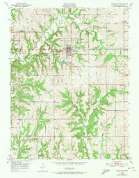
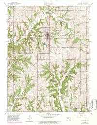
1951 Map of Oskaloosa
USGS Topo · Published 1974About this map
Oskaloosa serves as the central hub of this 1951 Jefferson County survey, surrounded by a rural landscape defined by its network of creeks and numerous rural institutions. The township lines of Fairview, Ozawkie, Kentucky, Rural, Sarcoxie, and Union intersect here, revealing a community that, by the early 1950s, was seeing a shift in its educational landscape. Many rural schoolhouses are noted as abandoned, including Buck Point Sch, Leaverton Sch, and Hinton Sch, while others like School No 10 and Dick Sch remained active points of interest.
Find a feature on this map
34 named features on this map. Tap any name to fly to it.
Don’t see what you’re looking for? This feature index may not catch every label — zoom into the map to look around manually.
Map Details
Editions of this 1951 Oskaloosa Map
5 editions found
Other maps of this area

1886 · Oskaloosa
USGS Topo · 1:125,000

1888 · Oskaloosa
USGS Topo · 1:125,000

1894 · Oskaloosa
USGS Topo · 1:125,000

1949 · Williamstown
USGS Topo · 1:24,000

1949 · Perry
USGS Topo · 1:24,000

1950 · Perry
USGS Topo · 1:24,000

1950 · Kansas City
USGS Topo · 1:250,000

1950 · Williamstown
USGS Topo · 1:24,000
1950 · Midland
USGS Topo · 1:24,000

1950 · Mc Louth
USGS Topo · 1:24,000