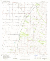
1964 Map of Valley Farms
USGS Topo · Published 1965About this map
Valley Farms serves as the primary hub of this Pinal County landscape in the mid-1960s, where an extensive network of irrigation features like the Pima Lateral and the Casa Grande Canal define the agricultural footprint. The map documents a transition from desert washes, such as McClellan Wash and Bogart Wash, to a highly organized grid of rural roads and homesteads. Educational and aviation landmarks are prominent, including the Kenilworth Sch and two distinct air facilities: Sarita Airport and the larger Coolidge Florence Municipal Airport. This survey provides a precise look at the desert's mid-century development, marked by named thoroughfares like Vah Ki Inn Road and Cactus Forest Road that connected isolated farms to the growing regional infrastructure.
Find a feature on this map
25 named features on this map. Tap any name to fly to it.
Don’t see what you’re looking for? This feature index may not catch every label — zoom into the map to look around manually.
Map Details
Editions of this 1964 Valley Farms Map
2 editions found
Other maps of this area

1900 · Florence
USGS Topo · 1:125,000

1902 · Florence
USGS Topo · 1:125,000

1907 · Sacaton
USGS Topo · 1:62,500

1922 · Red Rock No 2
USGS Topo · 1:48,000

1922 · Signal Peak
USGS Topo · 1:62,500

1924 · Signal Peak
USGS Topo · 1:62,500

1934 · Newman Peak
USGS Topo · 1:125,000

1954 · Mesa
USGS Topo · 1:250,000

1956 · Tucson
USGS Topo · 1:250,000

1957 · Mesa
USGS Topo · 1:250,000