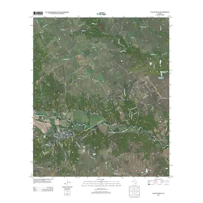
2012 Map of Valley Mills
USGS Topo · Published 2012About this map
The N Bosque River winds through this Central Texas landscape, anchoring the settlement of Valley Mills and its surrounding rural community. The township layout shows a concentration of local history at the river's edge, where the Old Valley Mills Cem and Valley Mills Cem reside alongside thoroughfares like FM 56. Outside the main town center, the landscape transitions into ranch land and small rural clusters such as Rock Springs. Notable social and industrial features include the Waco Boys Camp along the river and the Valley Mills Municipal Airport to the southeast. Water management is a defining characteristic of the area, evidenced by numerous named tanks and reservoirs like Taylor Lake, Markum Lake Number 1, and Markum Lake Number 2 that support the local agricultural economy. Terrain features like Thompson Hollow and the Horseshoe Bend of the river highlight the distinct local topography of Bosque County.
Find a feature on this map
80 named features on this map. Tap any name to fly to it.
Don’t see what you’re looking for? This feature index may not catch every label — zoom into the map to look around manually.
Map Details
Editions of this 2012 Valley Mills Map
This is the sole edition of this map. No revisions or reprints were ever made.
Other maps of this area

1888 · Meridian
USGS Topo · 1:125,000

1892 · Waco
USGS Topo · 1:125,000

1894 · Meridian
USGS Topo · 1:125,000

1920 · Waco
USGS Topo · 1:125,000

1924 · Waco 3-d
USGS Topo · 1:48,000

1931 · Whitney
USGS Topo · 1:62,500

1931 · Valley Mills
USGS Topo · 1:62,500

1954 · Waco
USGS Topo · 1:250,000

1955 · Waco
USGS Topo · 1:250,000

1955 · Clifton
USGS Topo · 1:24,000