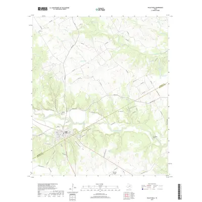
2019 Map of Valley Mills
USGS Topo · Published 2019About this map
Valley Mills sits at the heart of this landscape where the North Bosque River winds through central Texas. The terrain is defined by its dramatic contours, dropping into Thompson Hollow and curving around the prominent Horseshoe Bend of the river. A network of rural farm-to-market roads, including Farm Rd 56 and Farm Rd 1637, connects several historically significant burial grounds that speak to the area's pioneer roots. Researchers can identify Thiele Cem, Goodall Cem, and both the Valley Mills Cem and Old Valley Mills Cem. To the north, the landscape levels into a series of smaller drainages like Childress Cr and Hogan Cr, while human development is marked by the presence of the Valley Mills Municipal Airport and localized water features such as Taylor Lake and the Markum Lake Number 1 reservoirs.
Find a feature on this map
78 named features on this map. Tap any name to fly to it.
Don’t see what you’re looking for? This feature index may not catch every label — zoom into the map to look around manually.
Map Details
Editions of this 2019 Valley Mills Map
This is the sole edition of this map. No revisions or reprints were ever made.
Other maps of this area

1888 · Meridian
USGS Topo · 1:125,000

1892 · Waco
USGS Topo · 1:125,000

1894 · Meridian
USGS Topo · 1:125,000

1920 · Waco
USGS Topo · 1:125,000

1924 · Waco 3-d
USGS Topo · 1:48,000

1931 · Whitney
USGS Topo · 1:62,500

1931 · Valley Mills
USGS Topo · 1:62,500

1954 · Waco
USGS Topo · 1:250,000

1955 · Waco
USGS Topo · 1:250,000

1955 · Clifton
USGS Topo · 1:24,000