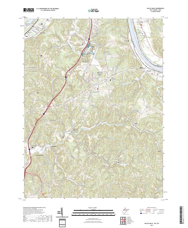
2023 Map of Valley Mills
USGS Topo · Published 2023About this map
The Ohio River corridor north of Parkersburg defines this landscape, where the state border with Ohio follows the river's path past Muskingum Island. The terrain is characterized by a series of parallel ridges and hollows, including Ashby Ridge and Spider Ridge, which rise sharply away from the river valley. Transportation and regional connectivity are centered on the Mid-Ohio Valley Regional Airport, which occupies a prominent plateau near Elmwood Heights. This modern infrastructure sits in contrast to the numerous small family and community burial grounds scattered across the hills, such as the Pugh Cem and Henderson Cem, which point to the long-standing rural settlement patterns of Wood County. Smaller residential pockets like Oakwood Estates and Mustang Acres have developed along the winding secondary roads that follow the contours of the land, while older communities like Waverly and Boaz anchor the riverfront and upland areas respectively.
Find a feature on this map
167 named features on this map. Tap any name to fly to it.
Don’t see what you’re looking for? This feature index may not catch every label — zoom into the map to look around manually.
Map Details
Editions of this 2023 Valley Mills Map
This is the sole edition of this map. No revisions or reprints were ever made.
Other maps of this area

1902 · Parkersburg
USGS Topo · 1:62,500

1904 · Parkersburg
USGS Topo · 1:62,500

1904 · Marietta
USGS Topo · 1:62,500

1906 · Elizabeth
USGS Topo · 1:62,500

1906 · Belleville
USGS Topo · 1:62,500

1924 · Belleville
USGS Topo · 1:62,500

1924 · Marietta
USGS Topo · 1:62,500

1924 · Elizabeth
USGS Topo · 1:62,500

1926 · Elizabeth
USGS Topo · 1:62,500

1926 · Belleville
USGS Topo · 1:62,500