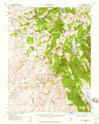
1956 Map of Valley Springs
USGS Topo · Published 1960About this map
Lancha Plana and Campo Seco anchor the northern landscape of this mid-century survey, situated along the Mokelumne River just as the region’s water and industrial patterns were shifting. The Southern Pacific railroad cuts through the terrain, connecting small hubs like Wallace, Burson (Helisma Station), and the namesake Valley Springs. The map documents a transition from old mining and ranching interests, evidenced by the McCarty Mine, Toyon sawmill, and Double Springs Ranch, toward large-scale water management. The footprint of Hogan Dam is visible, alongside the blue-shading indicating the anticipated reservoir inundation areas, which would soon forever alter the valley floor near Camanche. Numerous Clay Pits and family holdings like Rocabella Ranch and Ospital Ranch provide a detailed view of local land use before modern expansion.
Find a feature on this map
49 named features on this map. Tap any name to fly to it.
Don’t see what you’re looking for? This feature index may not catch every label — zoom into the map to look around manually.
Map Details
Editions of this 1956 Valley Springs Map
This is the sole edition of this map. No revisions or reprints were ever made.
Other maps of this area

1889 · Jackson
USGS Topo · 1:125,000

1892 · Jackson
USGS Topo · 1:125,000

1894 · Lodi
USGS Topo · 1:125,000

1897 · Jackson
USGS Topo · 1:125,000

1902 · Jackson
USGS Topo · 1:125,000

1908 · Linden
USGS Topo · 1:31,680

1909 · Goose Creek
USGS Topo · 1:31,680

1909 · Clements
USGS Topo · 1:31,680

1915 · Trigo
USGS Topo · 1:31,680

1915 · Peters
USGS Topo · 1:31,680