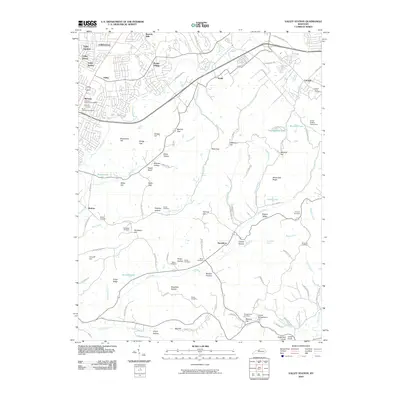
2010 Map of Valley Station
USGS Topo · Published 2010About this map
Valley Station and the suburban reaches of southwest Jefferson County are defined here by a transition from organized residential blocks to the high ridges and deep hollows of the Knobs region. The landscape reflects a legacy of family settlement and community foundations, evidenced by a high density of burial sites such as Bethany Memorial Cemetery and the South Jefferson Cemetery. While Prairie Village and Johnsontown represent the more developed northern corridor, the southern portion of the sheet shifts toward steep elevations like Jefferson Hill and Sugarloaf Knob. The presence of Tom Wallace Lake and the Jones Hollow Camp Area suggests a region valued for recreation and conservation, even as infrastructure like the railroad through Medora and roads winding through Blevins Gap connect these disparate terrains. Genealogists can find numerous family-named landmarks, from Kings Ridge to the McDaniel Cemetery, marking the heritage of those who inhabited these ridges.
Find a feature on this map
120 named features on this map. Tap any name to fly to it.
Don’t see what you’re looking for? This feature index may not catch every label — zoom into the map to look around manually.
Map Details
Editions of this 2010 Valley Station Map
This is the sole edition of this map. No revisions or reprints were ever made.
Other maps of this area

1907 · Louisville
USGS Topo · 1:62,500

1909 · Kosmosdale
USGS Topo · 1:48,000

1912 · Kosmosdale
USGS Topo · 1:62,500

1936 · Vine Grove
USGS Topo · 1:62,500

1943 · Vine Grove
USGS Topo · 1:62,500

1946 · Pitts Point
USGS Topo · 1:24,000

1946 · Fort Knox
USGS Topo · 1:24,000

1946 · Vine Grove
USGS Topo · 1:62,500

1949 · Shepherdsville
USGS Topo · 1:24,000

1949 · Shepherdsville
USGS Topo · 1:62,500