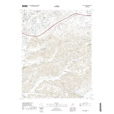
2019 Map of Valley Station
USGS Topo · Published 2019About this map
Waverly Hills and Valley Station anchor the northwestern portion of this terrain, where the suburban edges of Louisville meet the rising knobs and ridges of the Kentucky landscape. The area is defined by a heavy concentration of historical family and community burial grounds, including Bethany Memorial Cem, Horine Cem, and the South Jefferson Cem near Bethany. These sites, along with smaller settlements like Medora and Barrallton, indicate a long history of rural residence along the borders of Jefferson and Bullitt counties.
Find a feature on this map
110 named features on this map. Tap any name to fly to it.
Don’t see what you’re looking for? This feature index may not catch every label — zoom into the map to look around manually.
Map Details
Editions of this 2019 Valley Station Map
This is the sole edition of this map. No revisions or reprints were ever made.
Other maps of this area

1907 · Louisville
USGS Topo · 1:62,500

1909 · Kosmosdale
USGS Topo · 1:48,000

1912 · Kosmosdale
USGS Topo · 1:62,500

1936 · Vine Grove
USGS Topo · 1:62,500

1943 · Vine Grove
USGS Topo · 1:62,500

1946 · Pitts Point
USGS Topo · 1:24,000

1946 · Fort Knox
USGS Topo · 1:24,000

1946 · Vine Grove
USGS Topo · 1:62,500

1949 · Shepherdsville
USGS Topo · 1:24,000

1949 · Shepherdsville
USGS Topo · 1:62,500