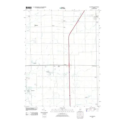
2010 Map of Van Buren
USGS Topo · Published 2010About this map
The town of Van Buren anchors the northeastern corner of this Grant County landscape, characterized by a dense network of agricultural ditches and small rural settlements. Communities such as Landess, Hanfield, and Shadeland dot the northern half of the quadrangle, while Brookhaven lies to the south near the Mississinewa River. The region's drainage is heavily managed through an intricate system of named channels including Tinkle Ditch, Pulley Ditch, and Tippey Ditch, which redirect water across the flat terrain. Local recreation and land use are visible at the Lincoln Country Club Lake and several smaller water bodies like Lake Wood and Lake Marion. For genealogists, the map is a primary source for locating family burials at several rural sites, including Fairview Cemetery, Masonic Cemetery, and Atkinson Cemetery, providing a spatial record of the area's established families.
Find a feature on this map
43 named features on this map. Tap any name to fly to it.
Don’t see what you’re looking for? This feature index may not catch every label — zoom into the map to look around manually.
Map Details
Editions of this 2010 Van Buren Map
This is the sole edition of this map. No revisions or reprints were ever made.
Other maps of this area

1950 · Warren
USGS Topo · 1:24,000

1950 · Mount Etna
USGS Topo · 1:24,000

1951 · Mount Etna
USGS Topo · 1:24,000

1952 · Warren
USGS Topo · 1:24,000

1953 · La Fontaine
USGS Topo · 1:24,000

1953 · Muncie
USGS Topo · 1:250,000

1956 · Muncie
USGS Topo · 1:250,000

1960 · Fairmount
USGS Topo · 1:24,000

1960 · Gas City
USGS Topo · 1:24,000

1960 · Hartford City West
USGS Topo · 1:24,000