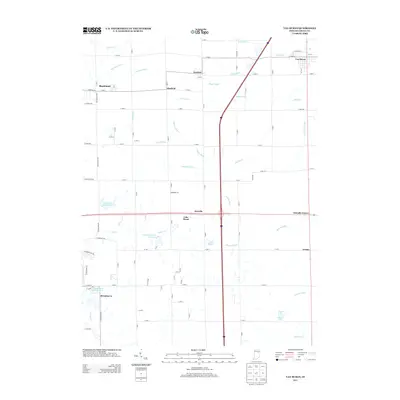
2013 Map of Van Buren
USGS Topo · Published 2013About this map
Van Buren occupies the northeastern corner of this Grant County landscape, serving as a primary hub for a region defined by extensive drainage networks and small rural clusters. The agricultural character of the area is mapped through a dense web of man-made waterways like Pulley Ditch, Tinkle Ditch, and Monroe Ditch, which channel water toward natural courses such as Roods Run and Walnut Cr. These ditches represent the long-term engineering required to sustain productivity in the Indiana till plains. Scattered settlements and named crossroads like Landess, Hanfield, and Shadeland punctuate the grid, while recreational and residential features appear at Lincoln Country Club Lake and the Brookhaven Addition Lake. The southern portion of the map transitions into more residential development near Brookhaven, contrasted by quiet locales such as Friendly Corner and Arcana to the east.
Find a feature on this map
92 named features on this map. Tap any name to fly to it.
Don’t see what you’re looking for? This feature index may not catch every label — zoom into the map to look around manually.
Map Details
Editions of this 2013 Van Buren Map
This is the sole edition of this map. No revisions or reprints were ever made.
Other maps of this area

1950 · Warren
USGS Topo · 1:24,000

1950 · Mount Etna
USGS Topo · 1:24,000

1951 · Mount Etna
USGS Topo · 1:24,000

1952 · Warren
USGS Topo · 1:24,000

1953 · La Fontaine
USGS Topo · 1:24,000

1953 · Muncie
USGS Topo · 1:250,000

1956 · Muncie
USGS Topo · 1:250,000

1960 · Fairmount
USGS Topo · 1:24,000

1960 · Gas City
USGS Topo · 1:24,000

1960 · Hartford City West
USGS Topo · 1:24,000