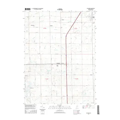
2016 Map of Van Buren
USGS Topo · Published 2016About this map
Van Buren and its surrounding agricultural townships reflect a landscape defined by an intricate network of drainage ditches and small settlements in the heart of Grant County. This modern survey illustrates the transition from traditional farm tracts to residential developments like Brookhaven and Brookhaven Addition Lake near the western edge of the quadrangle. Significant watercourses, including the Mississinewa River and Walnut Creek, carve through the terrain, while the rural grid is dotted with local history markers such as the Masonic Cem and Burson Cem. The survey detail captures the convergence of historical crossroads communities like Landess, Hanfield, and the vanished-sounding Arcana, providing a comprehensive view of how regional transportation corridors such as Montpelier Pike and Interstate 69 have reshaped local connectivity between these established agricultural centers.
Find a feature on this map
73 named features on this map. Tap any name to fly to it.
Don’t see what you’re looking for? This feature index may not catch every label — zoom into the map to look around manually.
Map Details
Editions of this 2016 Van Buren Map
This is the sole edition of this map. No revisions or reprints were ever made.
Other maps of this area

1950 · Warren
USGS Topo · 1:24,000

1950 · Mount Etna
USGS Topo · 1:24,000

1951 · Mount Etna
USGS Topo · 1:24,000

1952 · Warren
USGS Topo · 1:24,000

1953 · La Fontaine
USGS Topo · 1:24,000

1953 · Muncie
USGS Topo · 1:250,000

1956 · Muncie
USGS Topo · 1:250,000

1960 · Fairmount
USGS Topo · 1:24,000

1960 · Gas City
USGS Topo · 1:24,000

1960 · Hartford City West
USGS Topo · 1:24,000