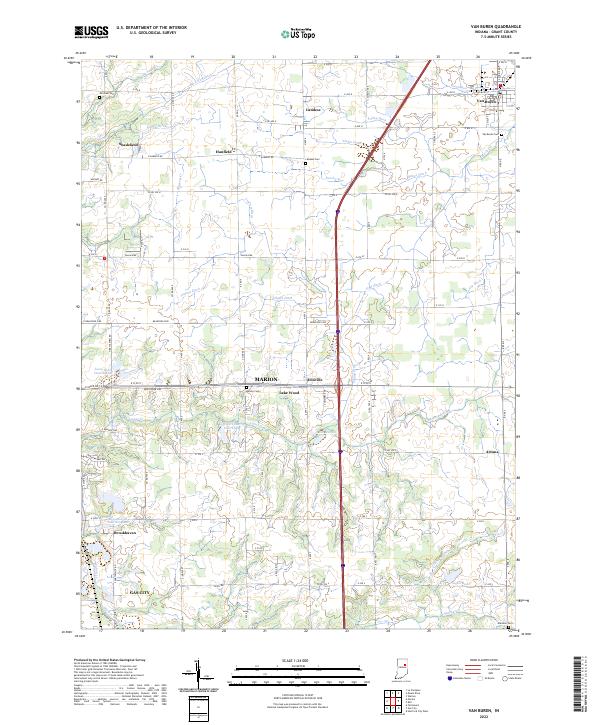
2022 Map of Van Buren
USGS Topo · Published 2022About this map
Van Buren and Landess anchor this 2022 depiction of Grant County, Indiana, showcasing a landscape defined by an extensive network of agricultural drainage and small settlements. The area is marked by numerous ditches such as Buck Run Ditch, Necessity Ditch, and Pulley Ditch, which illustrate the long-term engineering required to maintain the region's productive farmland. Small communities and named crossroads like Hanfield, Shadeland, and Dooville are interspersed between the larger centers of Van Buren and the outskirts of Gas City.
Find a feature on this map
68 named features on this map. Tap any name to fly to it.
Don’t see what you’re looking for? This feature index may not catch every label — zoom into the map to look around manually.
Map Details
Editions of this 2022 Van Buren Map
This is the sole edition of this map. No revisions or reprints were ever made.
Other maps of this area

1950 · Warren
USGS Topo · 1:24,000

1950 · Mount Etna
USGS Topo · 1:24,000

1951 · Mount Etna
USGS Topo · 1:24,000

1952 · Warren
USGS Topo · 1:24,000

1953 · La Fontaine
USGS Topo · 1:24,000

1953 · Muncie
USGS Topo · 1:250,000

1956 · Muncie
USGS Topo · 1:250,000

1960 · Fairmount
USGS Topo · 1:24,000

1960 · Gas City
USGS Topo · 1:24,000

1960 · Hartford City West
USGS Topo · 1:24,000