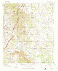
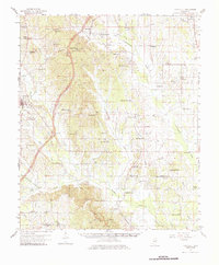
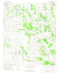
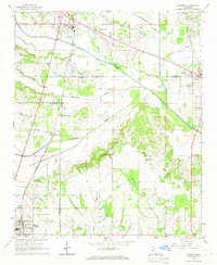
1959 Map of Van Vleet
USGS Topo · Published 1972About this map
Chuquatonchee Creek and Houlka Creek meander across this landscape in the late 1950s, defining a region where rural life centered on small crossroads and family names. The settlement of Van Vleet sits near the headwaters of Dicks Creek, while the town of Houston anchors the western edge, showing civic infrastructure like a Sewage Disposal and a Drive-in Theater. The map reveals a dense network of local genealogy, from the Jolly Cem and Reid Cem to numerous country churches like Bethlehem Ch and Providence Ch.
Find a feature on this map
96 named features on this map. Tap any name to fly to it.
Don’t see what you’re looking for? This feature index may not catch every label — zoom into the map to look around manually.
Map Details
Editions of this 1959 Van Vleet Map
3 editions found
Other maps of this area

1953 · West Point
USGS Topo · 1:250,000

1956 · Tupelo
USGS Topo · 1:250,000

1958 · Tupelo
USGS Topo · 1:250,000

1958 · West Point
USGS Topo · 1:250,000
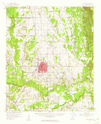
1959 · West Point
USGS Topo · 1:62,500
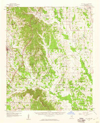
1959 · Van Vleet
USGS Topo · 1:62,500

1959 · Pheba
USGS Topo · 1:62,500

1963 · West Point
USGS Topo · 1:250,000
1965 · Egypt
USGS Topo · 1:24,000
1966 · Shannon
USGS Topo · 1:24,000