
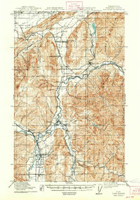
1919 Map of Van Zandt
USGS Topo · Published 1919About this map
Industrial activities and small timber-era settlements define this landscape along the United States - Canada border just after World War I. The region's natural resources are under active extraction, evidenced by the Olympic Portland Cement Company and the International Lime Plant near Limestone Junction. Along the waterways, the timber economy is visible through the Millers Shingle Mill and Cooperative Shingle Mill. The Nooksack River and its forks serve as the primary geographical anchors, supporting a network of small communities such as Van Zandt, Deming, and Maple Falls. Transportation is dominated by two major rail lines, the Chicago Milwaukee and St Paul RR and the Northern Pacific RR, which facilitate the movement of goods from remote sites like the Old Nooksack Mine. Local life centers on rural hubs including the Welcome Grange and several community schools.
Find a feature on this map
63 named features on this map. Tap any name to fly to it.
Don’t see what you’re looking for? This feature index may not catch every label — zoom into the map to look around manually.
Map Details
Editions of this 1919 Van Zandt Map
2 editions found
Other maps of this area

1906 · Sumas
USGS Topo · 1:62,500

1908 · Sumas
USGS Topo · 1:62,500

1909 · Mt Baker
USGS Topo · 1:192,000

1915 · Mt. Baker
USGS Topo · 1:250,000

1918 · Samish Lake
USGS Topo · 1:62,500

1921 · Wickersham
USGS Topo · 1:62,500

1951 · Wickersham
USGS Topo · 1:62,500

1951 · Van Zandt
USGS Topo · 1:62,500

1952 · Lake Whatcom
USGS Topo · 1:24,000

1952 · Lawrence
USGS Topo · 1:24,000