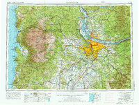
1958 Map of Vancouver
USGS Topo · Published 1976About this map
The Columbia River and Willamette River confluence anchors this mid-century look at the Pacific Northwest, as the metropolitan expansion around Portland meets the agricultural heart of the Willamette Valley. In the west, the Coast Range gives way to the dairy country of Tillamook and the narrow sand spit of Bayocean Peninsula. This 1974 revision includes significant military and conservation landmarks, such as Camp Adair Military Reservation and Saddle Mountain State Park. The region's transport network is shown in transition, with major rail lines like the S.P. Ry. and U.P. RR. serving the timber and farming communities of McMinnville, Lafayette, and Seaside. From the heights of the Cascade Range near Mount Hood to the rocky shoreline of Cape Meares, the map documents the infrastructure of the postwar Oregon coast and inland valleys.
Find a feature on this map
265 named features on this map. Tap any name to fly to it.
Don’t see what you’re looking for? This feature index may not catch every label — zoom into the map to look around manually.
Map Details
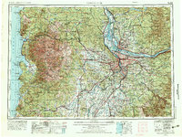
Editions of this 1958 Vancouver Map
3 editions found

Other maps of this area

1897 · Portland
USGS Topo · 1:62,500

1905 · Portland
USGS Topo · 1:62,500

1911 · Boring
USGS Topo · 1:48,000

1914 · Boring
USGS Topo · 1:62,500

1914 · Oregon City
USGS Topo · 1:62,500

1915 · Rickreall
USGS Topo · 1:31,680

1915 · Hillsboro
USGS Topo · 1:62,500

1915 · Eola
USGS Topo · 1:31,680

1916 · Tualatin
USGS Topo · 1:62,500

1916 · Estacada
USGS Topo · 1:125,000