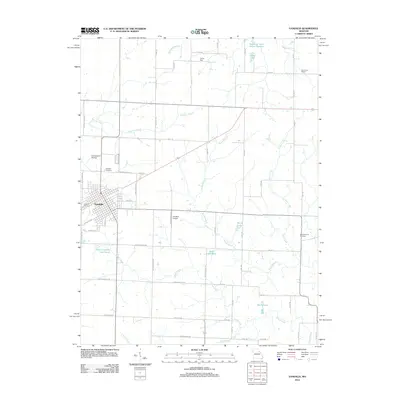
2012 Map of Vandalia
USGS Topo · Published 2012About this map
The city of Vandalia serves as the primary hub of this eastern Missouri landscape, where a grid of rural routes like Audrain Road 548 and Highway WW connects family farms and local landmarks. The area's agricultural and social foundations are evidenced by sites such as the Elm Grove School and the New Harmony Cemetery to the east. Water management is a defining characteristic of the terrain, visible through numerous private and public reservoirs, including the Weldon H. "Pete" Steiner Reservoir and Kohl Lake North. Small-scale aviation facilities like the Goodpasture Airstrip and Vandalia Airpark indicate the practical transport needs of this spread-out community. From the northern reaches of Spring Dale to the winding course of Indian Creek, the map details a region defined by its creeks, such as Spencer Creek and Shady Creek, which carve through the productive Audrain County countryside.
Find a feature on this map
64 named features on this map. Tap any name to fly to it.
Don’t see what you’re looking for? This feature index may not catch every label — zoom into the map to look around manually.
Map Details
Editions of this 2012 Vandalia Map
This is the sole edition of this map. No revisions or reprints were ever made.
Other maps of this area

1890 · Louisiana
USGS Topo · 1:125,000

1890 · Mexico
USGS Topo · 1:125,000

1942 · Wellsville
USGS Topo · 1:62,500

1942 · Bellflower
USGS Topo · 1:62,500

1943 · Vandalia
USGS Topo · 1:62,500

1945 · Bellflower
USGS Topo · 1:62,500

1945 · Perry
USGS Topo · 1:62,500

1945 · Vandalia
USGS Topo · 1:62,500

1948 · Quincy
USGS Topo · 1:250,000

1956 · Quincy
USGS Topo · 1:250,000