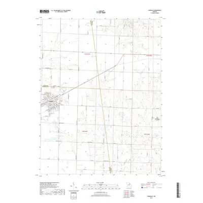
2017 Map of Vandalia
USGS Topo · Published 2017About this map
The street grid of Vandalia anchors this landscape at the intersection of Audrain, Ralls, and Pike counties. The town's residential and commercial core is detailed with local thoroughfares like W Washington St and W McPike St, leading toward the Vandalia Cem at the northern edge of the municipal boundary. Surrounding the town, the rural character is defined by a sophisticated water management network, including the substantial Weldon H. 'Pete' Steiner Reservoir and specialized agricultural features like Kohl Irrigation Lake N and Kohl Irrigation Lake S. To the east, the settlement of New Harmony persists near the New Harmony Cem. The terrain is drained by numerous winding waterways, notably Spencer Cr and Brush Br, which cut through the agricultural sections and divide the township ranges.
Find a feature on this map
109 named features on this map. Tap any name to fly to it.
Don’t see what you’re looking for? This feature index may not catch every label — zoom into the map to look around manually.
Map Details
Editions of this 2017 Vandalia Map
This is the sole edition of this map. No revisions or reprints were ever made.
Other maps of this area

1890 · Louisiana
USGS Topo · 1:125,000

1890 · Mexico
USGS Topo · 1:125,000

1942 · Wellsville
USGS Topo · 1:62,500

1942 · Bellflower
USGS Topo · 1:62,500

1943 · Vandalia
USGS Topo · 1:62,500

1945 · Bellflower
USGS Topo · 1:62,500

1945 · Perry
USGS Topo · 1:62,500

1945 · Vandalia
USGS Topo · 1:62,500

1948 · Quincy
USGS Topo · 1:250,000

1956 · Quincy
USGS Topo · 1:250,000