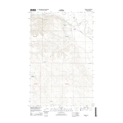
2014 Map of Vandalia
USGS Topo · Published 2014About this map
Vandalia serves as the focal point for this section of the Milk River valley, where the landscape is defined by the extensive irrigation works of the Vandalia S Canal. This infrastructure, essential to the region's agricultural viability, parallels the river's winding course as it snakes through the prairie. The surrounding terrain is deeply incised by a network of drainage coulees, such as Ash Coulee, Buffalo Coulee, and Hay Coulee, which draw water from the higher benches down toward the river bottom. These natural features create a complex topography that dictated the placement of local thoroughfares like Ash Coulee Rd and Tampico Rd. Further south, the map reveals the more remote drainages of South Fork Traux Coulee and Hardscrabble Cr, illustrating the transition from the irrigated valley floor to the more isolated grazing lands of Valley County.
Find a feature on this map
22 named features on this map. Tap any name to fly to it.
Don’t see what you’re looking for? This feature index may not catch every label — zoom into the map to look around manually.
Map Details
Editions of this 2014 Vandalia Map
This is the sole edition of this map. No revisions or reprints were ever made.
Other maps of this area

1906 · Hinsdale Special Map
USGS Topo · 1:62,500

1943 · Glasgow
USGS Topo · 1:125,000

1954 · Glasgow
USGS Topo · 1:250,000

1957 · Glasgow
USGS Topo · 1:250,000

1958 · Glasgow
USGS Topo · 1:250,000

1958 · Engstrom Ranch
USGS Topo · 1:24,000

1958 · Miller Coulee
USGS Topo · 1:62,500
1958 · Billick Coulee
USGS Topo · 1:24,000
1969 · Tampico
USGS Topo · 1:24,000

1969 · Vandalia
USGS Topo · 1:24,000