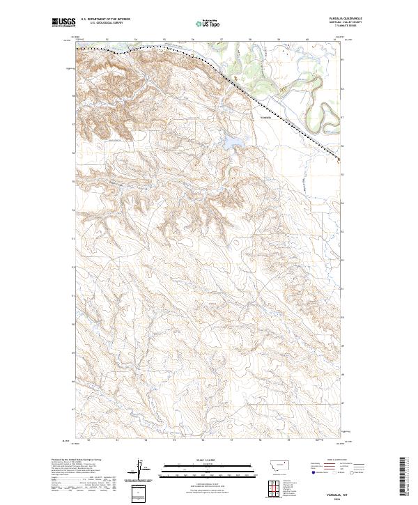
2024 Map of Vandalia
USGS Topo · Published 2024About this map
Milk River meanders across the northern plains of Valley County, creating a fertile ribbon of bottomland defined by the Vandalia South Canal and the small community of Vandalia. This agricultural landscape is dominated by a complex system of drainage features, where numerous coulees—including Long Coulee, Buffalo Coulee, and Hardpan Coulee—carve through the uplands toward the river valley. The settlement pattern is largely dictated by the irrigation infrastructure and local transport routes such as Montfort Rd and Vandalia Rd. South of the river, the terrain rises into more dissected country, where Bob Coulee and Pebble Creek drain the open range. The map details a modern rural economy still centered on the water management and ranching traditions of north-central Montana.
Find a feature on this map
18 named features on this map. Tap any name to fly to it.
Don’t see what you’re looking for? This feature index may not catch every label — zoom into the map to look around manually.
Map Details
Editions of this 2024 Vandalia Map
This is the sole edition of this map. No revisions or reprints were ever made.
Other maps of this area

1906 · Hinsdale Special Map
USGS Topo · 1:62,500

1943 · Glasgow
USGS Topo · 1:125,000

1954 · Glasgow
USGS Topo · 1:250,000

1957 · Glasgow
USGS Topo · 1:250,000

1958 · Glasgow
USGS Topo · 1:250,000

1958 · Engstrom Ranch
USGS Topo · 1:24,000

1958 · Miller Coulee
USGS Topo · 1:62,500
1958 · Billick Coulee
USGS Topo · 1:24,000
1969 · Tampico
USGS Topo · 1:24,000

1969 · Vandalia
USGS Topo · 1:24,000