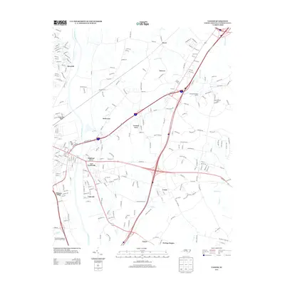
2013 Map of Vander
USGS Topo · Published 2013About this map
The Cape Fear River flows along the western edge of this 2013 landscape, defining the topography of Cumberland County as it reaches toward East Fayetteville. The area is characterized by a dense network of suburban residential developments and rural enclaves, including Rivercliff, Highland Acres, and Vander. Transport and industry are central to this corridor, anchored by the Eastover Air Ranch Airport and the convergence of major transit arteries like Interstate 95 and Highway 301.
Find a feature on this map
234 named features on this map. Tap any name to fly to it.
Don’t see what you’re looking for? This feature index may not catch every label — zoom into the map to look around manually.
Map Details
Editions of this 2013 Vander Map
This is the sole edition of this map. No revisions or reprints were ever made.
Other maps of this area

1948 · Fayetteville
USGS Topo · 1:62,500

1948 · Slocomb
USGS Topo · 1:24,000

1949 · Vander
USGS Topo · 1:24,000

1950 · Fayetteville
USGS Topo · 1:24,000

1950 · Manchester
USGS Topo · 1:24,000

1950 · Slocomb
USGS Topo · 1:24,000

1953 · Florence
USGS Topo · 1:250,000

1953 · Raleigh
USGS Topo · 1:250,000

1954 · Florence
USGS Topo · 1:250,000

1954 · Raleigh
USGS Topo · 1:250,000
Featured Places
- Fayetteville, NC
- Heritage Heights, NC
- Beard, Eastover
- Williams Village, Fayetteville
- Rivercliff, Fayetteville