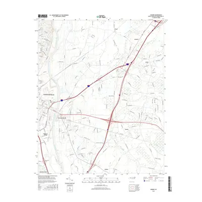
2016 Map of Vander
USGS Topo · Published 2016About this map
Fayetteville and its eastern suburbs are documented here in 2016, showing a landscape defined by the winding Cape Fear River and a complex network of transportation and water management. The area transition from the urban density of Williams Village and East Fayetteville to the low-lying wetlands of Bakers Swamp and Duck Pond Swamp. Notable for genealogists is the Cross Creek Cem located near the city center, while the Fayetteville Regional Airport/Grannis Field dominates the southwestern corner. The map also captures the rural-to-suburban character of smaller communities like Vander, Eastover, and Beard. Evidence of local irrigation and drainage can be found in features like the Gum Log Canal and Locks Cr, which intersect with the significant highway interchanges that tie these settlements to the broader region.
Find a feature on this map
159 named features on this map. Tap any name to fly to it.
Don’t see what you’re looking for? This feature index may not catch every label — zoom into the map to look around manually.
Map Details
Editions of this 2016 Vander Map
This is the sole edition of this map. No revisions or reprints were ever made.
Other maps of this area

1948 · Fayetteville
USGS Topo · 1:62,500

1948 · Slocomb
USGS Topo · 1:24,000

1949 · Vander
USGS Topo · 1:24,000

1950 · Fayetteville
USGS Topo · 1:24,000

1950 · Manchester
USGS Topo · 1:24,000

1950 · Slocomb
USGS Topo · 1:24,000

1953 · Florence
USGS Topo · 1:250,000

1953 · Raleigh
USGS Topo · 1:250,000

1954 · Florence
USGS Topo · 1:250,000

1954 · Raleigh
USGS Topo · 1:250,000
Featured Places
- Fayetteville, NC
- Heritage Heights, NC
- Beard, Eastover
- Williams Village, Fayetteville
- Rivercliff, Fayetteville