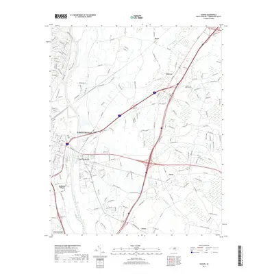
2019 Map of Vander
USGS Topo · Published 2019About this map
The Cape Fear River serves as the dominant geographic boundary in this portrait of eastern Cumberland County, where the urban expansion of Fayetteville meets the more rural stretches of North Carolina's coastal plain. The map documents a complex transition from established city neighborhoods to specialized land uses, such as the Eastover Air Ranch Airport and the sprawling industrial-to-suburban corridors of East Fayetteville and Vander. Smaller, distinct communities like Beard, Williams Village, and Judson represent the older settlement patterns that preceded the region's modern infrastructure growth.
Find a feature on this map
177 named features on this map. Tap any name to fly to it.
Don’t see what you’re looking for? This feature index may not catch every label — zoom into the map to look around manually.
Map Details
Editions of this 2019 Vander Map
This is the sole edition of this map. No revisions or reprints were ever made.
Other maps of this area

1948 · Fayetteville
USGS Topo · 1:62,500

1948 · Slocomb
USGS Topo · 1:24,000

1949 · Vander
USGS Topo · 1:24,000

1950 · Fayetteville
USGS Topo · 1:24,000

1950 · Manchester
USGS Topo · 1:24,000

1950 · Slocomb
USGS Topo · 1:24,000

1953 · Florence
USGS Topo · 1:250,000

1953 · Raleigh
USGS Topo · 1:250,000

1954 · Florence
USGS Topo · 1:250,000

1954 · Raleigh
USGS Topo · 1:250,000
Featured Places
- Fayetteville, NC
- Heritage Heights, NC
- Beard, Eastover
- Williams Village, Fayetteville
- Rivercliff, Fayetteville