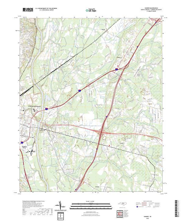
2022 Map of Vander
USGS Topo · Published 2022About this map
The Cape Fear River serves as the western boundary for this landscape where the urban reach of Fayetteville meets the rural transitions of Cumberland County. The map documents a blend of established neighborhoods like Williams Village and East Fayetteville alongside outlying communities such as Vander, Eastover, and Beard. These areas are connected by a dense network of local roads and major thoroughfares, including the convergence of highways 24 210 and 53 210.
Find a feature on this map
172 named features on this map. Tap any name to fly to it.
Don’t see what you’re looking for? This feature index may not catch every label — zoom into the map to look around manually.
Map Details
Editions of this 2022 Vander Map
This is the sole edition of this map. No revisions or reprints were ever made.
Other maps of this area

1948 · Fayetteville
USGS Topo · 1:62,500

1948 · Slocomb
USGS Topo · 1:24,000

1949 · Vander
USGS Topo · 1:24,000

1950 · Fayetteville
USGS Topo · 1:24,000

1950 · Manchester
USGS Topo · 1:24,000

1950 · Slocomb
USGS Topo · 1:24,000

1953 · Florence
USGS Topo · 1:250,000

1953 · Raleigh
USGS Topo · 1:250,000

1954 · Florence
USGS Topo · 1:250,000

1954 · Raleigh
USGS Topo · 1:250,000