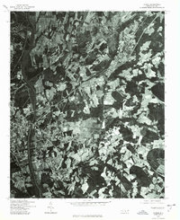
1976 Map of Vander
USGS Topo · Published 1978About this map
Fayetteville anchor the western edge of this mid-1970s orthophotoquad, where the expanding urban footprint meets the agricultural landscape of Cumberland County. The aerial imagery reveals the transition from dense street grids and industrial riverside development to the more dispersed patterns of Vander to the east. This specialized map format, produced in cooperation with the Soil Conservation Service, uses rectified photography to show land use patterns, field boundaries, and forest cover with a clarity traditional topographic lines often omit. It captures the region during a period of significant growth, showing the intricate network of roads and clearings that characterize the suburban expansion surrounding one of North Carolina's major hubs.
Find a feature on this map
2 named features on this map. Tap any name to fly to it.
Don’t see what you’re looking for? This feature index may not catch every label — zoom into the map to look around manually.
Map Details
Editions of this 1976 Vander Map
This is the sole edition of this map. No revisions or reprints were ever made.
Other maps of this area

1948 · Fayetteville
USGS Topo · 1:62,500

1948 · Slocomb
USGS Topo · 1:24,000

1949 · Vander
USGS Topo · 1:24,000

1950 · Fayetteville
USGS Topo · 1:24,000

1950 · Manchester
USGS Topo · 1:24,000

1950 · Slocomb
USGS Topo · 1:24,000

1953 · Florence
USGS Topo · 1:250,000

1953 · Raleigh
USGS Topo · 1:250,000

1954 · Florence
USGS Topo · 1:250,000

1954 · Raleigh
USGS Topo · 1:250,000