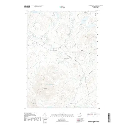
2019 Map of Vanderwhacker Mountain
USGS Topo · Published 2019About this map
The Hudson River carves through the northern reaches of this Adirondack landscape, where the rugged topography of Essex County is defined by the North River Mountains and the prominent peak of Vanderwhacker Mtn. Within the Adirondack Park Preserve, the map reveals a complex network of high-elevation water bodies and drainages, including Hyslop Pond, Vanderwhacker Pond, and the southern flow of the Boreas River toward Stillwater. Local history is anchored by the Saint Therese Cem situated near the intersection of Blueridge Rd and Co Hwy 28. The distribution of seasonal access roads like Moose Pond Club Rd and Campsite Rd suggests the area's long-standing role for timber management and wilderness recreation, while landmarks such as Hewitt Eddy and Moose Pond identify specific points of interest for those tracing the traditional geography of the Minerva region.
Find a feature on this map
48 named features on this map. Tap any name to fly to it.
Don’t see what you’re looking for? This feature index may not catch every label — zoom into the map to look around manually.
Map Details
Editions of this 2019 Vanderwhacker Mountain Map
This is the sole edition of this map. No revisions or reprints were ever made.
Other maps of this area

1895 · Mt. Marcy
USGS Topo · 1:62,500

1897 · Schroon Lake
USGS Topo · 1:62,500

1898 · Newcomb
USGS Topo · 1:62,500

1901 · Newcomb
USGS Topo · 1:62,500

1902 · Mt. Marcy
USGS Topo · 1:62,500

1904 · Santanoni
USGS Topo · 1:62,500

1948 · Ogdensburg
USGS Topo · 1:250,000

1950 · Glens Falls
USGS Topo · 1:250,000

1950 · Lake Champlain
USGS Topo · 1:250,000

1950 · Utica
USGS Topo · 1:250,000