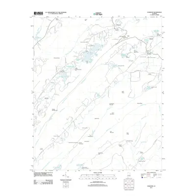
2011 Map of Vandiver
USGS Topo · Published 2011About this map
Double Oak Mountain and Coosa Mountain define the topography of this corner of Alabama, where residential development and recreational lakes meet established rural communities. Near the Vandiver Post Office, the landscape is dotted with several significant burial grounds, including the Union Hill Cemetery and the Vandiver Negro Cemetery, reflecting the area's ancestral history. To the west, the Shoal Creek Golf Course represents a modern transition in land use, while the southern reaches feature the Chelsea Game Preserve Lake. The infrastructure of the era is evidenced by the Coosa Tunnel through the ridges and the Signal Mountain Lookout Tower, which provides a vantage point over the dense network of ridges such as Pine Mountain and Sand Mountain. Numerous family-named cemeteries like Weldon Cemetery and Hollis Cemetery are scattered throughout the winding roads of the ridge-and-valley terrain.
Find a feature on this map
145 named features on this map. Tap any name to fly to it.
Don’t see what you’re looking for? This feature index may not catch every label — zoom into the map to look around manually.
Map Details
Editions of this 2011 Vandiver Map
This is the sole edition of this map. No revisions or reprints were ever made.
Other maps of this area

1889 · Springville
USGS Topo · 1:125,000

1889 · Birmingham
USGS Topo · 1:125,000

1890 · Bessemer
USGS Topo · 1:125,000

1890 · Talladega
USGS Topo · 1:125,000

1892 · Birmingham
USGS Topo · 1:125,000

1892 · Springville
USGS Topo · 1:125,000

1892 · Talladega
USGS Topo · 1:125,000

1892 · Bessemer
USGS Topo · 1:125,000

1895 · Birmingham
USGS Topo · 1:125,000

1905 · Leeds
USGS Topo · 1:62,500