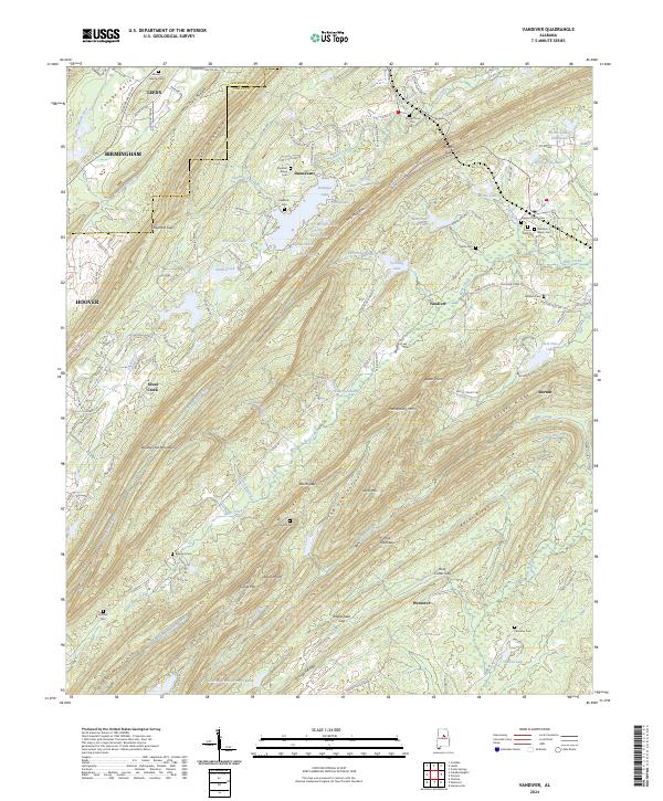
2024 Map of Vandiver
USGS Topo · Published 2024About this map
The Jefferson and Shelby County line cuts across a landscape dominated by the northeast-to-southwest ridges of the Appalachian foothills. Oak Mountain and Double Oak Mountain define the topography, creating narrow valleys where small settlements like Vandiver, Dunnavant, and Sterrett took root. The area's social history is deeply etched into the land through numerous small burial grounds, including the Vandiver Negro Cem, Union Hill Cem, and Hollis Cem, reflecting a heritage of rural kinship and community.
Find a feature on this map
140 named features on this map. Tap any name to fly to it.
Don’t see what you’re looking for? This feature index may not catch every label — zoom into the map to look around manually.
Map Details
Editions of this 2024 Vandiver Map
This is the sole edition of this map. No revisions or reprints were ever made.
Other maps of this area

1889 · Springville
USGS Topo · 1:125,000

1889 · Birmingham
USGS Topo · 1:125,000

1890 · Bessemer
USGS Topo · 1:125,000

1890 · Talladega
USGS Topo · 1:125,000

1892 · Birmingham
USGS Topo · 1:125,000

1892 · Springville
USGS Topo · 1:125,000

1892 · Talladega
USGS Topo · 1:125,000

1892 · Bessemer
USGS Topo · 1:125,000

1895 · Birmingham
USGS Topo · 1:125,000

1905 · Leeds
USGS Topo · 1:62,500