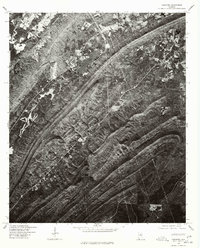
1975 Map of Vandiver
USGS Topo · Published 1977About this map
Vandiver and the surrounding Shelby County ridges are captured in high detail through this 1975 orthophotomap, produced by the Geological Survey in cooperation with the Soil Conservation Service. The imagery reveals a landscape defined by the distinct northeast-southwest folds of the Appalachian foothills, where clearings for small farms and homesteads contrast sharply against the heavily wooded slopes. The primary water feature is Wehapa Lake, which sits nestled among these ridges northwest of the town center. Because this is an orthophotograph rather than a standard topographic line map, researchers can examine the literal texture of the land—tracing the exact footprints of homes, the density of timber, and the winding paths of rural roads as they existed in the mid-1970s.
Find a feature on this map
2 named features on this map. Tap any name to fly to it.
Don’t see what you’re looking for? This feature index may not catch every label — zoom into the map to look around manually.
Map Details
Editions of this 1975 Vandiver Map
This is the sole edition of this map. No revisions or reprints were ever made.
Other maps of this area

1889 · Springville
USGS Topo · 1:125,000

1889 · Birmingham
USGS Topo · 1:125,000

1890 · Bessemer
USGS Topo · 1:125,000

1890 · Talladega
USGS Topo · 1:125,000

1892 · Birmingham
USGS Topo · 1:125,000

1892 · Springville
USGS Topo · 1:125,000

1892 · Talladega
USGS Topo · 1:125,000

1892 · Bessemer
USGS Topo · 1:125,000

1895 · Birmingham
USGS Topo · 1:125,000

1905 · Leeds
USGS Topo · 1:62,500