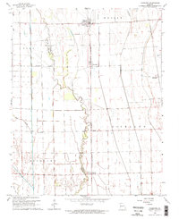
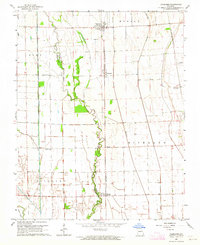
1963 Map of Vanduser
USGS Topo · Published 1964About this map
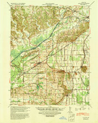
The agricultural heart of Scott Co is defined by a highly managed water system, visible in this mid-century survey through the extensive network of Spoil Bank features alongside the meandering Little River. This drainage-rich landscape in the Missouri Bootheel supports small rail-oriented communities like Vanduser and Crowder, which developed along the St Louis - San Francisco railroad corridor. The map captures a moment when rural life centered on local institutions such as Pilgrim Rest Ch and Friendship Ch.
Find a feature on this map
17 named features on this map. Tap any name to fly to it.
Don’t see what you’re looking for? This feature index may not catch every label — zoom into the map to look around manually.
Map Details
Editions of this 1963 Vanduser Map
2 editions found
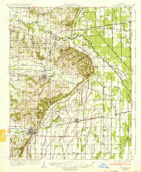
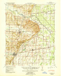
Other maps of this area

1931 · Sikeston
USGS Topo · 1:62,500

1934 · Morley
USGS Topo · 1:62,500
1934 · Bloomfield
USGS Topo · 1:62,500

1934 · Sikeston
USGS Topo · 1:62,500

1934 · Advance
USGS Topo · 1:62,500
1939 · Bloomfield
USGS Topo · 1:62,500

1939 · Sikeston
USGS Topo · 1:62,500

1939 · Morley
USGS Topo · 1:62,500
1939 · Advance
USGS Topo · 1:62,500

1949 · Paducah
USGS Topo · 1:250,000