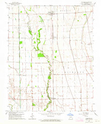
1963 Map of Vanduser
USGS Topo · Published 1964About this map
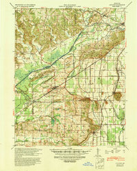
Vanduser and the small settlements of Crowder, Tanner, and McMullin sit amidst a heavily engineered agricultural landscape along the Scott and Stoddard County line. The terrain is defined by the legacy of the Little River Drainage District, evidenced by the prominent spoil banks that flank the channelized Little River. These man-made features reflect the massive early 20th-century effort to reclaim the swampland of the Bootheel for cultivation. The St Louis - San Francisco railroad provides the primary north-south spine for the region, connecting these rural hubs. Local life centers on landmarks like Pilgrim Rest Ch, Friendship Ch, and Carpenter Cem, while the natural remnants of the landscape persist in the winding paths of Crooked Slough and Mud Slough near Clines Island.
Find a feature on this map
18 named features on this map. Tap any name to fly to it.
Don’t see what you’re looking for? This feature index may not catch every label — zoom into the map to look around manually.
Map Details
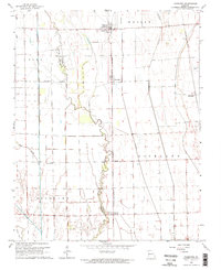
Editions of this 1963 Vanduser Map
2 editions found
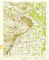
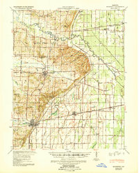
Other maps of this area

1931 · Sikeston
USGS Topo · 1:62,500

1934 · Morley
USGS Topo · 1:62,500
1934 · Bloomfield
USGS Topo · 1:62,500

1934 · Sikeston
USGS Topo · 1:62,500

1934 · Advance
USGS Topo · 1:62,500
1939 · Bloomfield
USGS Topo · 1:62,500

1939 · Sikeston
USGS Topo · 1:62,500

1939 · Morley
USGS Topo · 1:62,500
1939 · Advance
USGS Topo · 1:62,500

1949 · Paducah
USGS Topo · 1:250,000