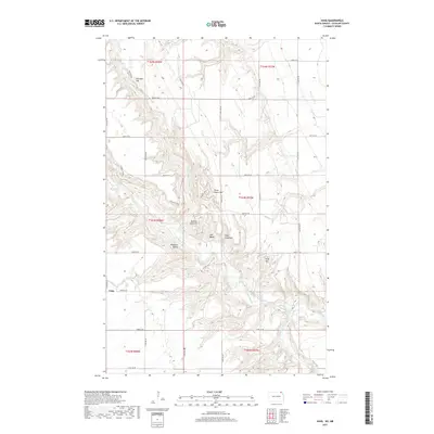
2017 Map of Vang
USGS Topo · Published 2017About this map
Vang and the surrounding high ground of Cavalier County are defined by the intricate carving of the Pembina River and its tributaries. In this modern survey, the landscape reveals a clear distinction between the flat, agricultural tablelands and the deeply eroded valley systems. Named peaks such as Kjemhus Hill, Three Sisters Hill, and Norman Otto Hill rise above the drainage of the Little North Pembina River, illustrating the topographical complexity of this corner of North Dakota. The settlement of Pembina Valley sits within this low-lying river corridor, while Vang itself occupies a more exposed position to the west. Local landmarks like Trappers Ridge and Point Kneeshaw provide specific points of reference for those studying the physical geography and land-use patterns of the region's northern reaches.
Find a feature on this map
36 named features on this map. Tap any name to fly to it.
Don’t see what you’re looking for? This feature index may not catch every label — zoom into the map to look around manually.
Map Details
Editions of this 2017 Vang Map
This is the sole edition of this map. No revisions or reprints were ever made.
Other maps of this area

1918 · Walhalla
USGS Topo · 1:62,500

1943 · Walhalla
USGS Topo · 1:62,500

1952 · Thief River Falls
USGS Topo · 1:250,000

1953 · Devils Lake
USGS Topo · 1:250,000

1956 · Thief River Falls
USGS Topo · 1:250,000

1956 · Devils Lake
USGS Topo · 1:250,000

1957 · Thief River Falls
USGS Topo · 1:250,000

1964 · Walhalla
USGS Topo · 1:24,000
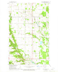
1964 · Hanks Corner
USGS Topo · 1:24,000

1967 · Thief River Falls
USGS Topo · 1:250,000