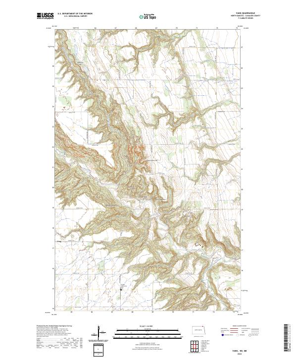
2024 Map of Vang
USGS Topo · Published 2024About this map
Vang serves as a central point in this northern North Dakota landscape, where the deeply carved Pembina Valley dominates the terrain of Cavalier County. The map reveals a complex drainage system where the Little North Pembina River and Little South Pembina River converge with the main branch of the Pembina River. The topography is defined by high points often named for local families or landmarks, such as Norman Otto Hill, Kjemhus Hill, and Point Kneeshaw. The presence of the Gospel Tabernacle Cem provides a significant touchstone for genealogists and local historians tracking early community roots. Recreational and agricultural access is shown through named trails like Trapper's Ridge Trl and Fisher's Descent Trl, which navigate the steep descents into the river valley, illustrating the enduring relationship between the settlers and this intricate corridor of the Red River Basin.
Find a feature on this map
38 named features on this map. Tap any name to fly to it.
Don’t see what you’re looking for? This feature index may not catch every label — zoom into the map to look around manually.
Map Details
Editions of this 2024 Vang Map
This is the sole edition of this map. No revisions or reprints were ever made.
Other maps of this area

1918 · Walhalla
USGS Topo · 1:62,500

1943 · Walhalla
USGS Topo · 1:62,500

1952 · Thief River Falls
USGS Topo · 1:250,000

1953 · Devils Lake
USGS Topo · 1:250,000

1956 · Thief River Falls
USGS Topo · 1:250,000

1956 · Devils Lake
USGS Topo · 1:250,000

1957 · Thief River Falls
USGS Topo · 1:250,000

1964 · Walhalla
USGS Topo · 1:24,000
1964 · Hanks Corner
USGS Topo · 1:24,000

1967 · Thief River Falls
USGS Topo · 1:250,000