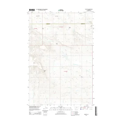
2014 Map of Vanstel
USGS Topo · Published 2014About this map
Vanstel and its surrounding ranchlands sit at the intersection of deeply eroded coulees and high prairie flats near the northern edge of Rosebud County. This 2014 survey documents a landscape defined by water drainage and topographical relief, where the Garfield Co Rosebud Co line cuts through the northern section of the quadrangle. The settlement's history is anchored by the Vanstel Cem, while the natural geography is marked by distinctive landmarks such as Blacktail Butte and the broad Acorn Flats.
Find a feature on this map
18 named features on this map. Tap any name to fly to it.
Don’t see what you’re looking for? This feature index may not catch every label — zoom into the map to look around manually.
Map Details
Editions of this 2014 Vanstel Map
This is the sole edition of this map. No revisions or reprints were ever made.
Other maps of this area

1954 · Forsyth
USGS Topo · 1:250,000

1957 · Forsyth
USGS Topo · 1:250,000

1958 · Forsyth
USGS Topo · 1:250,000

1960 · Brown Coulee
USGS Topo · 1:24,000

1965 · Acorn Flats
USGS Topo · 1:24,000

1965 · Kramer Ranch
USGS Topo · 1:24,000
1965 · Mother Butte
USGS Topo · 1:24,000
1965 · Antelope Springs
USGS Topo · 1:24,000

1965 · Vanstel
USGS Topo · 1:24,000

1965 · Stellar Lake
USGS Topo · 1:24,000