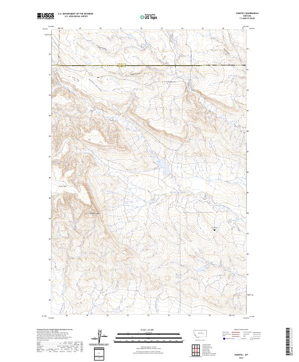
2024 Map of Vanstel
USGS Topo · Published 2024About this map
The northern edge of Rosebud County meets Garfield County in this drainage-carved landscape of coulees and high flats. Modern topographic data reveals the isolated location of the Vanstel Cem, a small burial ground situated near the headwaters of Little Porcupine Creek. This area is defined by its complex network of seasonal watercourses, including Magpie Coulee, Lehner Coulee, and Leach Coulee, which cut through the terrain toward larger basins. High points like Blacktail Butte overlook broad, level areas such as Acorn Flats to the west. Near the southern boundary, the presence of a Hot Spring at the edge of Coyote Creek suggests the unique geothermal hydrology of this sparsely populated Montana region. The map also traces the distinct paths of Blacktail Creek and East Blacktail Creek as they meander through the southern townships.
Find a feature on this map
17 named features on this map. Tap any name to fly to it.
Don’t see what you’re looking for? This feature index may not catch every label — zoom into the map to look around manually.
Map Details
Editions of this 2024 Vanstel Map
This is the sole edition of this map. No revisions or reprints were ever made.
Other maps of this area

1954 · Forsyth
USGS Topo · 1:250,000

1957 · Forsyth
USGS Topo · 1:250,000

1958 · Forsyth
USGS Topo · 1:250,000

1960 · Brown Coulee
USGS Topo · 1:24,000

1965 · Acorn Flats
USGS Topo · 1:24,000

1965 · Kramer Ranch
USGS Topo · 1:24,000
1965 · Mother Butte
USGS Topo · 1:24,000
1965 · Antelope Springs
USGS Topo · 1:24,000

1965 · Vanstel
USGS Topo · 1:24,000

1965 · Stellar Lake
USGS Topo · 1:24,000