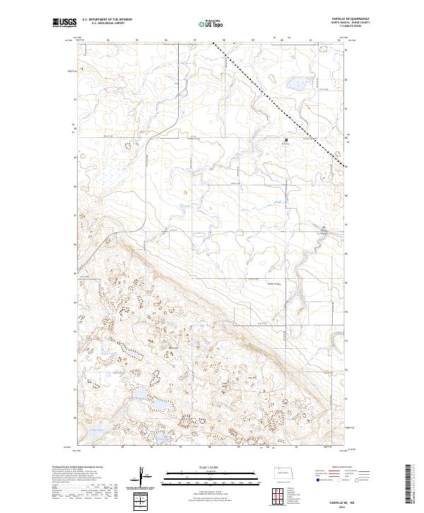
2024 Map of Vanville NE
USGS Topo · Published 2024About this map
The rolling prairies of Burke County are defined here by a series of glacial depressions and low-lying coulees that serve as vital drainage for the agricultural plateau. Little Butte rises prominently in the southern half of the quadrangle, overlooking the nearby Little Butte Cem. This area reveals a classic North Dakota section-line road grid, where travel follows the rigid geometry of the Public Land Survey System, as seen along 73rd Ave NW and 90th St NW.
Find a feature on this map
29 named features on this map. Tap any name to fly to it.
Don’t see what you’re looking for? This feature index may not catch every label — zoom into the map to look around manually.
Map Details
Editions of this 2024 Vanville NE Map
This is the sole edition of this map. No revisions or reprints were ever made.
Other maps of this area

1947 · Bowbells
USGS Topo · 1:24,000

1948 · Coteau
USGS Topo · 1:24,000

1948 · Woburn
USGS Topo · 1:24,000

1948 · Vanville NE
USGS Topo · 1:24,000

1949 · Mosquito Butte
USGS Topo · 1:24,000

1949 · Bowbells
USGS Topo · 1:24,000

1949 · Niobe
USGS Topo · 1:24,000

1950 · Vanville NE
USGS Topo · 1:24,000

1950 · Bowbells
USGS Topo · 1:62,500

1950 · Kenmare
USGS Topo · 1:62,500