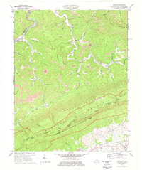
1974 Map of Varilla
USGS Topo · Published 1977About this map
Cumberland Gap National Historical Park anchors the southern portion of this mid-1970s survey, marking the intersection of Kentucky, Virginia, and Tennessee. The landscape is dominated by the steep ridges of Cumberland Mountain and Brush Mountain, which dictate the settlement patterns of small communities like Varilla, Calvin, and Cubage. The area's industrial character is defined by extensive extraction operations, with numerous strip mines following the contours of the terrain near Sugarcamp and Black Mountain.
Find a feature on this map
71 named features on this map. Tap any name to fly to it.
Don’t see what you’re looking for? This feature index may not catch every label — zoom into the map to look around manually.
Map Details
Editions of this 1974 Varilla Map
3 editions found
Other maps of this area

1886 · Cumberland Gap
USGS Topo · 1:125,000

1887 · Jonesville
USGS Topo · 1:125,000

1888 · Cumberland Gap
USGS Topo · 1:125,000

1891 · Cumberland Gap
USGS Topo · 1:125,000

1891 · Jonesville
USGS Topo · 1:125,000

1903 · Harlan
USGS Topo · 1:48,000

1903 · Pineville
USGS Topo · 1:48,000

1903 · Middlesboro
USGS Topo · 1:48,000

1916 · Harlan
USGS Topo · 1:48,000

1919 · Harlan
USGS Topo · 1:62,500