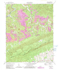
1974 Map of Varilla
USGS Topo · Published 1991About this map
The Cumberland River carves a sharp path through the northwestern corner of this Bell County landscape, where the settlement of Varilla sits at the foot of Laurel Hill. This 1974 revision documents a region defined by extensive extractive activity, with Strip Mine operations sprawling across the high ridges of Black Mountain and Hances Ridge. These industrial footprints contrast with the long-established social fabric of the hollows, marked by family-named landmarks such as the Barnett Cem and Miracle Cem.
Find a feature on this map
66 named features on this map. Tap any name to fly to it.
Don’t see what you’re looking for? This feature index may not catch every label — zoom into the map to look around manually.
Map Details
Editions of this 1974 Varilla Map
3 editions found
Other maps of this area

1886 · Cumberland Gap
USGS Topo · 1:125,000

1887 · Jonesville
USGS Topo · 1:125,000

1888 · Cumberland Gap
USGS Topo · 1:125,000

1891 · Cumberland Gap
USGS Topo · 1:125,000

1891 · Jonesville
USGS Topo · 1:125,000

1903 · Harlan
USGS Topo · 1:48,000

1903 · Pineville
USGS Topo · 1:48,000

1903 · Middlesboro
USGS Topo · 1:48,000

1916 · Harlan
USGS Topo · 1:48,000

1919 · Harlan
USGS Topo · 1:62,500