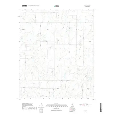
2019 Map of Vashti
USGS Topo · Published 2019About this map
Vashti sits at the junction of several farm-to-market roads in the southeastern corner of Clay County, serving as a focal point for the surrounding cattle and ranching country. The landscape is defined by the headwaters and tributaries of several prominent waterways, including the winding Buffalo Cr and Smith Cr, which carve through the terrain. Evidence of modern land management is visible in the Soil Conservation Service Site 4 Reservoir, a significant water feature in the eastern half of the quadrangle.
Find a feature on this map
52 named features on this map. Tap any name to fly to it.
Don’t see what you’re looking for? This feature index may not catch every label — zoom into the map to look around manually.
Map Details
Editions of this 2019 Vashti Map
This is the sole edition of this map. No revisions or reprints were ever made.
Other maps of this area

1905 · Montague
USGS Topo · 1:125,000

1954 · Sherman
USGS Topo · 1:250,000

1954 · Wichita Falls
USGS Topo · 1:250,000

1958 · Wichita Falls
USGS Topo · 1:250,000

1958 · Sherman
USGS Topo · 1:250,000

1961 · Stoneburg
USGS Topo · 1:24,000

1961 · Brushy Mound
USGS Topo · 1:24,000

1961 · Selma
USGS Topo · 1:24,000
1963 · Vashti
USGS Topo · 1:24,000
1964 · Newport
USGS Topo · 1:24,000