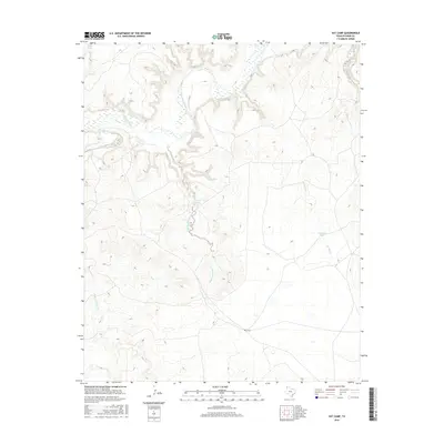
2016 Map of Vat Camp
USGS Topo · Published 2016About this map
The Canadian River cuts through this portion of Oldham County, defining a landscape of deep drainages and vital water sources in the Texas Panhandle. At the heart of this ranching country sits Vat Camp, a named site surrounded by a network of seasonal waterways including Trujillo Creek and Agua de Piedra Cr. The presence of Charvez Spring and Dripping Springs underscores the historical importance of reliable water in this arid environment, where even small features like W Dam Tank represent critical infrastructure for land management. This 2016 survey provides a precise look at the modern drainage patterns of Lost Horse Creek and W Dam Cr, offering a detailed view of the terrain before it reaches the broader river valley.
Find a feature on this map
12 named features on this map. Tap any name to fly to it.
Don’t see what you’re looking for? This feature index may not catch every label — zoom into the map to look around manually.
Map Details
Editions of this 2016 Vat Camp Map
This is the sole edition of this map. No revisions or reprints were ever made.
Other maps of this area

1954 · Tucumcari
USGS Topo · 1:250,000

1958 · Tucumcari
USGS Topo · 1:250,000

1966 · Signal Spring
USGS Topo · 1:24,000

1966 · Adrian
USGS Topo · 1:24,000

1966 · Signal Spring SE
USGS Topo · 1:24,000

1966 · Big George Tank
USGS Topo · 1:24,000

1966 · Vat Camp
USGS Topo · 1:24,000

1966 · Trujillo Camp
USGS Topo · 1:24,000

1971 · Romero SE
USGS Topo · 1:24,000

1971 · Knoblaw
USGS Topo · 1:24,000